Belgian Research Station Antarctica
Background information on the Sør Rondane Mountains
prepared & maintained by F. Pattyn @ ULB

|
Belgian Research Station AntarcticaBackground information on the Sør Rondane Mountainsprepared & maintained by F. Pattyn @ ULB |
|
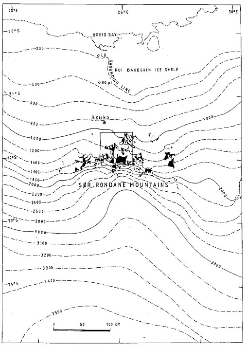
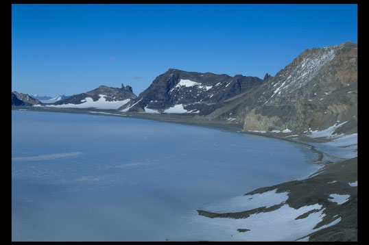
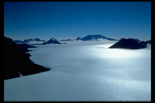
The Sør Rondane is a typical coastal margin mountain range in Eastern Dronning Maud Land, stretching over a distance of 220 km in east-west direction, situated approximately 200 km from the coast, with the highest elevation being 3000 m a.s.l.. This range forms part of a chain of mountains surrounding the East Antarctic continent from the Borg Massif in Western Dronning Maud Land (5 deg W - 73 deg S) to the Yamato Mountains in Eastern Dronning Maud Land (35 deg E - 72 deg S), which forms the border with the ice sheet of Enderby Land and the Shirase Drainage Basin. Most of the ice flow coming from the polar plateau is drained along both sides of the Sør Rondane, giving rise to two large outlet glaciers, Hansenbreen in the west and Byrdbreen in the east. A small number of outlet glaciers cut through the range, all characterised by varying ice fluxes (Gunnestadbreen, Jenningsbreen, Gjelbreen, ...). From airborne radio echo sounding it was found that the subglacial topography south of the mountain range lies well above sea level (1000 to 2000 m a.s.l.), while between the Sør Rondane and the coast the ice sheet has a marine configuration with a bedrock elevation ranging from -100 to -300 m a.s.l. Therefore, at the coast, the ice sheet is drained into a well-developed ice shelf (Roi Baudouin Ice Shelf).
Maps, topographic maps, geologic maps, documents and research papers, Belgian and Japanese publications, satellite imagery and aerial photographs on the Sør Rondane and its surroundings can be consulted at the Laboratoire de Glaciologie. Contact: F. Pattyn (email: fpattyn@ulb.ac.be), Laboratoire de Glaciologie, Université Libre de Bruxelles, Av. Depage 30, DC4.118. Tel: 02/650 28 46.
|
|
A more exhaustive introduction to the Sør Rondane can be found in T. Van Autenboer (The geomorphology and glacial geology of the Sør Rondane, Dronning Maud Land, Antarctica). I selected some paragraphs from this work that give a nice description of the area.
The different areas listed below can be considered as individual geographical units and they will be described here from the coast southwards:
In comparison with other ice shelves, which form the seaward margin of a large part of the Antarctic continent on which Base Roi Baudouin is sited is probably one of the smallest. The heavily indented coastline is formed by 20-30 m high cliffs.
On the line from Base Roi Baudouin to Romnaesfjellet no crevasses other that the ones at the foot of the hill have been observed, while to the east and the west of this zone, snow-free and seracced areas have been seen from aircraft. This is probably a narrow zone with reduced movement protected by the Sør Rondane. The seracced areas to the east and west of this crevasse-free zone mark the contact between the more actively flowing zones (ice streams) to the east and west.
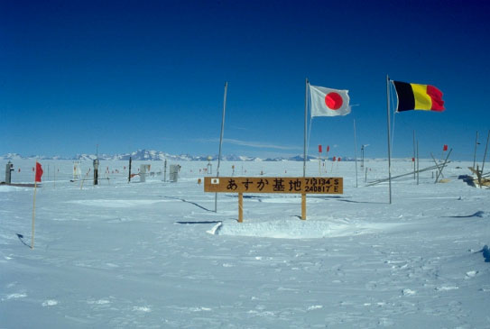
The granitic nunatak Romnaesfjellet, which breaks the monotony of the slowly rising ice slope, forms a natural sub-division for the profile. From Romnaesfjellet southwards, there is a piedmont zone formed by the confluence of the different glaciers of the Sør Rondane. As individual geographic features, the glaciers within the range have disappeared, because separating ridges protruding from the ice are absent and heavy local accumulation masks marginal features. Along a gravity profile from the small nunatak called "Seal" (100 m form the Japanese Asuka Base), 8 km south-east of Romnaesfjellet, to the Sør Rondane indicates an ice thickness of over 1000 m.
Romnaesfjellet (1280 m) rises 356 m above the snow surface. Seal (956 m) is only 32 m above the present glacier level.
The Sør Rondane Mountains form a distinct physiographic unit belonging to the mountain ranges which follow the Antarctic coastline. The peaks of these mountains, rising to 4000 m, can be seen from the coast in clear weather. This mountain range is wedge-shaped, widening towards the east, and the distance from the isolated nunataks forming the apex of the wedge in the west of the range attains its maximum of 90 km.
To the west the nearest mountains are those of the Wohltatmassivet, but isolated nunataks occur between them and the Sør Rondane. Between Balchenfjella and Belgicafjella to the east no other nunataks have so far been reported.
The mountains of the Sør Rondane were seen and photographed from the air for the first time in 1937 during the Norwegian expedition of Lars Christensen, and a map was made from these photographs. A second map (1957) was made from air photographs taken by the US Navy operation ‘Highjump’ of 1946-1947. The first geological reconnaissance was carried out in 1958 by Picciotto and in 1959 and 1960 by Van Autenboer.
No systematic meteorological observations have been made in the Sør Rondane. Sledge parties visited the mountains only during the warmer part of the year. Temperatures were recorded for topographic and gravimetric survey work by alcohol thermometer. The respective maximum and minimum temperatures recorded were 0°C (1959) and -49°C (April 1960).
Since south-easterly winds are predominant, the eastern part of the mountain range is far more exposed to the wind. Although weather conditions curtailed travelling and fieldwork for a considerable number of days, on the whole day proved to be better, although colder, than at the coast. The boundary between the bad weather, which is generally associated with the coastal zone, and the more settled weather of the mountains seems to be in the vicinity of Romnaesfjellet.
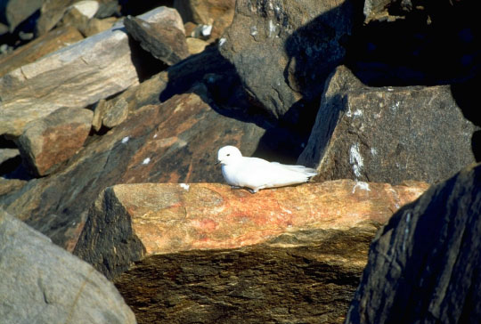
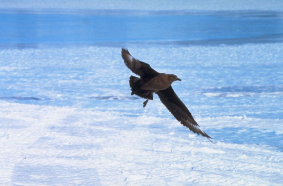
Snow petrels (Pagodroma nivea) are by far the most frequently observed birds in the Sør Rondane. Petrel rookeries sometimes totalling several hundred birds have been seen on some rock outcrops. All of the rookeries recorded lie in the protected western part of the range and the number of birds seen diminished rapidly towards the east. A few skuas (Stercoriarius maccornicki) are usual seen around the rookeries feeding on the petrels. Several different lichens were found. Here again the western part of the mountains proved to be the richer area. They occur at altitudes varying from one to several hundred meters above the present snow surface.
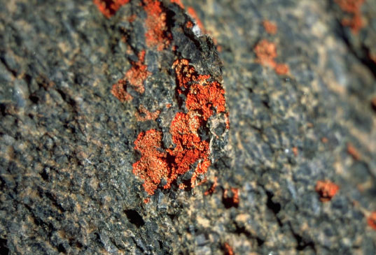
The Sør Rondane forms part of the shield area of Eastern Antarctica, from which a Precambrian age is accepted. The predominant rock types belong to a high-grade metamorphic series, consisting of different types of gneiss, amphibolites, greenschists and various types of migmatites associated with anatexitic granitic massifs. Limestone and pure marble lenses are abundant especially in the western part of the range. Other larger granitic and dioritic massifs to the north and west of the range are thought to be intrusive.
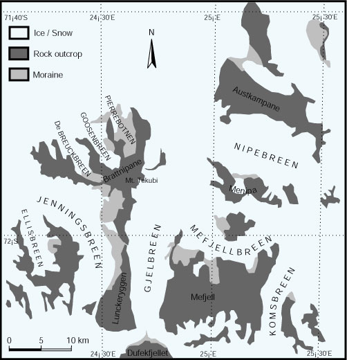
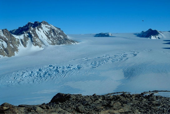
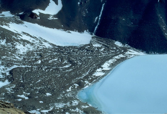
In a broad sense, the Sør Rondane acts like a barrier damming the glacier flow from the polar plateau (continental ice sheet). Glaciers draining the ice from the plateau cut through the mountain range in a general south-north direction and subdivide the mountains into their major topographical units. In addition to the main outlet glaciers, a local glacier system independent of flow from the plateau has developed; small local ice caps; mountain (alpine) and cirque glaciers have created the alpine character of the range.
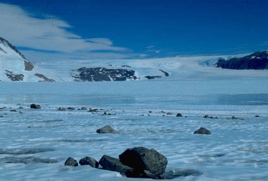
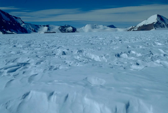
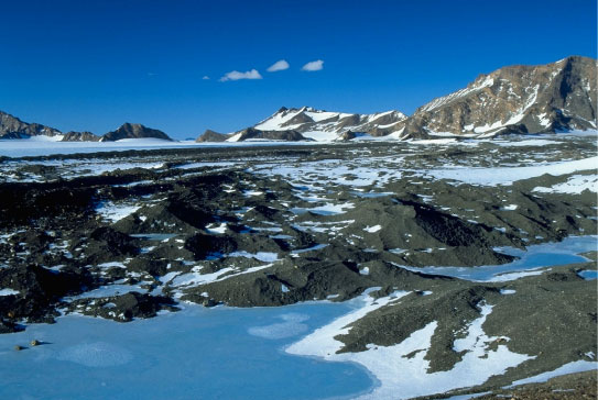
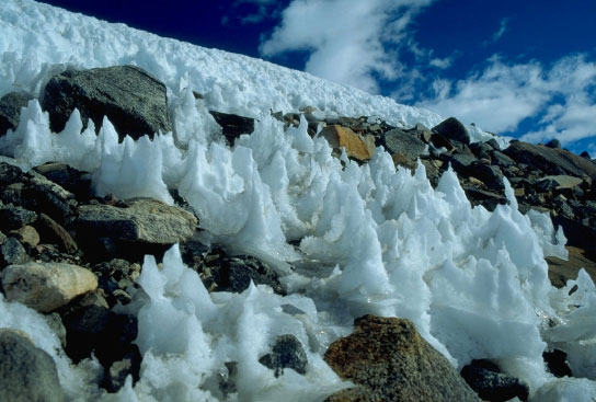
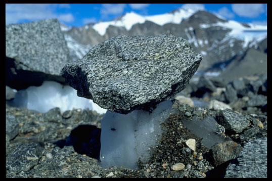
Areas of solid blue ice are widely distributed in the Sør Rondane. Their surfaces are usually scolloped and rippled, and progress across them is difficult. The ice is homogeneous and this can best be seen where pebbles or boulders have sunk through the ice or where cryoconite holes occur. Small patches of snow are present in the areas but they are frequently eroded away in a few days or even hours, showing that they are purely temporary features. Moraines are often found crossing blue ice field, and glacier tables have been occasionally observed where larger boulders and block protect the underlying ice.
|
|
|
|
|
|
|
|
|
|
|
|
|
|
|
|
|
|
|
|
|
|
|
|